 The deep forests of the Appalachian Mountains are amazing. Time seems to tick away very slowly which gives you time to appreciate what is around you. There are no houses, loud noises, cars, and human settlement seems light-years away. It's just you and the sweet sound of the thrush.
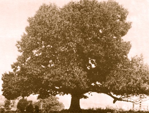
The forest has changed quite a bit over the past 2 centuries. There are very few trees left that were here 200 years ago. Most have been cut for wood and paper and new trees have taken their place. There are still isolated pockets of old-growth trees here and there though. Wells, NY in the Adirondacks has a great stand of old-growth white pine. Species have changed as well. The American Chestnut, a massive tree that could get to ten feet in diameter and 100 ft tall, used to be the major tree in the forest...1 in 4 were chestnut. Today they are all gone; killed off by a fungus in only 35 years that hitched a ride here from Asia. The Appalachians lost 4 BILLION of these trees. Scientists are working to restore the chestnut. Some of this work is happening right in Syracuse.
The American Elm is another example of a tree of the past. These trees used to line the streets of the US because of their unique shape. They have been killed off by Dutch Elm Disease. There are still a few around Groton that I've seen that have not gotten infected. So get out there and experience the woods the way it is right now!
The Deep Forest
on 29 April 2009Snakes
on 28 April 2009
nearby. It was about 4 ft long and all black. We thought it was either
a rat snake or a king snake. Can someone look up those 2 and see if
either match the description. Thanks!

started a campfire. When we got to the ridgetop we noticed the whole
hillside was on fire. We came within less than a mile of it. It's been
very hot and dry lately...perfect for fire. Later on someone mentioned
that a ranger said it was a planned, controlled fire. Now my question
is, why would the forest service intentionally set a forest fire? If
you can figure out the answer please leave it in the comment section.
MotionX GPS Track: Spring Mtn to Hemlock Hollow
on 27 April 2009Hello,
Mr. DeVoe uses MotionX-GPS on the iPhone 3G and is sharing with you the following track:
| Name: | Spring Mtn to Hemlock Hollow |
| Date: | Apr 27, 2009 8:33 am |
| Distance: | 5.43 miles |
| Elapsed Time: | 2:43:07 |
| Avg Speed: | 2.0 mph |
| Max Speed: | 7.6 mph |
| Avg Pace: | 30' 01" per mile |
| Min Altitude: | 2,151 ft |
| Max Altitude: | 3,481 ft |
| Start Time: | 2009-04-27T12:33:18Z |
| Start Location: | |
| Latitude: | 35.951997º N |
| Longitude: | 82.790115º W |
| End Time: | 2009-04-27T15:16:26Z |
| End Location: | |
| Latitude: | 35.998796º N |
| Longitude: | 82.775199º W |
Click on this link to display the track in Google Maps. This link will be valid until May 27, 2009 12:50 PM PDT.
There are two files attached to this email:
"Spring Mtn to Hemlock Hollow.kmz" is a Google KML track that can be displayed in Google Earth or Google Maps.
"Spring Mtn to Hemlock Hollow.gpx" is an Open Standard track that can be displayed by select mapping software.
MotionX-GPS Commonly Asked Questions:
| Q1: | What is MotionX-GPS? |
| A1: | MotionX-GPS, available for the iPhone 3G, is the essential application for hikers, bike riders, joggers, and geocaching enthusiasts. It puts an easy-to-use, state-of-the-art handheld GPS system on your iPhone 3G. |
| Q2: | Can I use MotionX-GPS? |
| A2: | Sure! MotionX-GPS Lite for the iPhone 3G is free and can be downloaded from the iTunes App Store here. |
| Q3: | How can I display tracks in Google Earth? |
| A3: | Follow the directions on the Google Earth web site to download and install the Google Earth program. Save the attached Spring Mtn to Hemlock Hollow.kml file to your computer. Launch Google Earth, select File, Open, and open the saved Spring Mtn to Hemlock Hollow.kml file. |
| Q4: | What is a GPX Track? |
| A4: | GPX stands for GPS Exchange Format and is used to transfer GPS data between many GPS devices and applications, including Google Earth. A track is a path recorded by MotionX-GPS showing movement over the surface of the Earth. |
| Q5: | This e-mail was forwarded to me and I can't find the attachments! |
| A5: | Some e-mail programs do not include the original attachments by default when forwarding an e-mail. In this case, the sender must reattach the original files for them to be included. |
Please contact us here with any comments or questions.
All the best,
The MotionX Team
US and Foreign Patents Granted and Pending. Fullpower® is a registered trademark of Fullpower Technologies, Inc. MotionX™ is a trademark of Fullpower Technologies, Inc. © Copyright 2003 - 2009 Fullpower Technologies, Inc. All rights reserved.
ref-id: 0bb44342-61f5-4e1c-bed0-efb8d97ba929
My GPS Position
on 26 April 2009Sent from my iPhone

Hot Springs after a restful day off at a cabin outside of town. It's
now almost 1 pm and it's almost 90 degrees out so we're taking a slow
pace. Everything is great so far though. We've done 8 miles and are
shooting for about 14 total today.
Kevin and Lucy
on 25 April 2009
tested out my tent to make sure the three of us fit alright. I'm
carrying the tent and he's carrying the stove and fuel to reduce
weight. Tomorrow morning we set off North.
Sent from my iPhone

because the nights are getting warmer I watched the sunset from the
forested mountainside and slipped into a deep sleep around 8pm. Kevin
and Lucy are meeting up with me tomorrow after a couple "real world"
setbacks.
Hello,
Mr. DeVoe uses MotionX-GPS on the iPhone 3G and is sharing with you the following track:
| Name: | Max Patch to Lemon Gap |
| Date: | Apr 23, 2009 12:01 pm |
| Distance: | 5.20 miles |
| Elapsed Time: | 1:56:39 |
| Avg Speed: | 2.7 mph |
| Max Speed: | 7.3 mph |
| Avg Pace: | 22' 26" per mile |
| Min Altitude: | 3,341 ft |
| Max Altitude: | 4,541 ft |
| Start Time: | 2009-04-23T16:01:21Z |
| Start Location: | |
| Latitude: | 35.797309º N |
| Longitude: | 82.956798º W |
| End Time: | 2009-04-23T17:58:00Z |
| End Location: | |
| Latitude: | 35.825220º N |
| Longitude: | 82.937489º W |
Click on this link to display the track in Google Maps. This link will be valid until May 24, 2009 12:00 PM PDT.
There are two files attached to this email:
"Max Patch to Lemon Gap.kmz" is a Google KML track that can be displayed in Google Earth or Google Maps.
"Max Patch to Lemon Gap.gpx" is an Open Standard track that can be displayed by select mapping software.
MotionX-GPS Commonly Asked Questions:
| Q1: | What is MotionX-GPS? |
| A1: | MotionX-GPS, available for the iPhone 3G, is the essential application for hikers, bike riders, joggers, and geocaching enthusiasts. It puts an easy-to-use, state-of-the-art handheld GPS system on your iPhone 3G. |
| Q2: | Can I use MotionX-GPS? |
| A2: | Sure! MotionX-GPS Lite for the iPhone 3G is free and can be downloaded from the iTunes App Store here. |
| Q3: | How can I display tracks in Google Earth? |
| A3: | Follow the directions on the Google Earth web site to download and install the Google Earth program. Save the attached Max Patch to Lemon Gap.kml file to your computer. Launch Google Earth, select File, Open, and open the saved Max Patch to Lemon Gap.kml file. |
| Q4: | What is a GPX Track? |
| A4: | GPX stands for GPS Exchange Format and is used to transfer GPS data between many GPS devices and applications, including Google Earth. A track is a path recorded by MotionX-GPS showing movement over the surface of the Earth. |
| Q5: | This e-mail was forwarded to me and I can't find the attachments! |
| A5: | Some e-mail programs do not include the original attachments by default when forwarding an e-mail. In this case, the sender must reattach the original files for them to be included. |
Please contact us here with any comments or questions.
All the best,
The MotionX Team
US and Foreign Patents Granted and Pending. Fullpower® is a registered trademark of Fullpower Technologies, Inc. MotionX™ is a trademark of Fullpower Technologies, Inc. © Copyright 2003 - 2009 Fullpower Technologies, Inc. All rights reserved.
ref-id: f705ad71-1939-453d-86e1-79fb4516b641
.jpg) Hi Everyone,
Hi Everyone,
After about 270 miles and averaging a little over 13 miles a day, I am now in Hot Springs, NC at the library and wanted to answer some of the great questions you guys have been asking. First the bear...around midnight some of us in the shelter (there were about 12 total sleeping at the time) heard a couple bears come through camp. I saw the silhouette of a baby black bear. Mom was over ripping apart my bear canister at that point. After about 15 minutes she gave up on the canister and tried ripping down the cables that held the other hikers' food up. Luckily no one lost their food and the 2 bears left. Skoob didn't hear the bears and I'm glad because I'm sure he would have freaked out. I'm learning he's pretty shy!
I've been eating a lot of healthy dinners but I have to admit, I've been eating A LOT of junk food! But I guess it's ok because I'm burning around 5,000 calories a day. I am hungry pretty much all of the time! I think about food when I hike, I get constant cravings for real food, and sometimes when I am close to towns my legs get a mind of their own and move me quicker in hopes of reaching a restaurant. Some people have asked if they can send stuff. First of all, don't feel like you have to BUT I eat a lot of things like Candy bars, combos, Oatmeal Pies, trail mix, dried fruit, etc.
Despite the blisters and sore knees, everything is fine. Even the blisters have gotten better. I don't think anyone can walk from Georgia to Maine without some discomfort.
It's very nice to see all of the wonderful comments and I'm so happy to see that the elementary classes are following along. I try my hardest to post as much as I can because I know everyone is following along. I miss you all!
-Mr. DeVoe
ps. This isn't a bear I saw. I stole the image from the internet.
People
on 23 April 2009
of people in their 20s and 30s but also a lot of retired couples,
women in their 50s hiking alone, a 6 year old did it once as well as a
blind man and I ran into an 86 year old trying to redo his own record
as the oldest person ever to hike the whole thing.
This is "Kea", one of the guys I've been hiking with. He is from New
Zealand. He's pretty interesting. He doesn't own a house or a car or
many posesions at all. He just saves up money and hikes around the
world. He told me stories about hiking in Spain, Russia, Tibet, etc.
I've been helping him with our birds and trees that we meet. He's been
telling me about all of the cool birds in NZ, an island with only 2
species of bats as their sole native mammal. As a result many of their
birds lost the ability to fly because it wasn't needed to escape
predators. However, since humans arrived and brought cats, rats,
possums and stuff like that many birds have become extinct or
endangered. However, as Kea put it, NZ is still " an island of birds,
mate"!

Mountains. 35.7973N 82.9568W. You should get a good view in Google
Earth. There is also some sort of data collection tower here.
12seconds iPhone Video Notification
on 22 April 2009| New 12seconds Video! | |
12seconds user Cdevoe wanted you to see the new video they created using the new 12seconds iPhone Application. Check it out here: http://tiny12.tv/2UCJW
| |
© 2008-2009 12seconds.tv
| |
Hi Everyone...
Just a short recap from the Smokies. I ended up hiking the 68 miles of the Smokies in only 4 days. Most people take 5-6 and I am paying for it. It rained (or snowed) for 3 of the 4 days. The constant hiking in soaked feet, slopping around in the mud has saturated my feet and caused several blisters (one in between my big and second toe). Not fun! I stayed last night at Standing Bear Farm/Hostel and plan to only put in about 7 miles later today. The Smokies were nice though. A lot of it reminded me of the Northeast forests with lots of red pine, balsam fir, and yellow birch. A lot of the trail followed ridgelines where the trail was about 8 feet wide with 50-100M vertical drops on each side. I had approximately 30 M visibility at Clingman's Dome though which was disappointing because that is the highest point on the whole AT. Beside the rain, the other bad aspect was that because of bear activity everyone HAD to sleep in a shelter. We were often crammed in, sleeping right next to complete strangers. The last night I slept next to the loudest snorer I've ever heard. It sounded like there was a dying cat in there the whole night and I only got about 4 hrs of sleep. Hope all is well with everyone.
The Smokies
on 20 April 2009 The Smoky Mountains National Park is located along the Tennessee/ North Carolina border and is the most popular national park in the United States. 2009 marks the 75th anniversary of this park, which is one of the richest areas in the world in terms of it's multitude of plant and animal life. It's mountains are also some of the oldest in the world, formed some 200-300 million years ago. The park contains 100 species of trees, 2000 species of fungi, and 1500 species of flowering plants. It is also home to more than 200 species of birds, 66 types of mammals, 50 native fish species, 39 varieties of reptiles, and 43 species of amphibians...more salamanders than anywhere else in the world. It's a pretty amazing place.
The park is also very threatened. Factory and automobile pollution along with acid rain are killing the trees in the park, particularly to Frasier Fir. I'll be doing my part to help by cleaning shelters that have garbage and walking in the middle of the trail to cut down on erosion.
Field test
on 19 April 2009
worked. Around midnight several of us woke to a loud growl as a couple
bears strolled into camp. I could hear them batting and scraping the
canister but they couldn't gain access to my 4 day food supply. They
mangeled it pretty good though and i found it about 75 meters from
where I placed it. Welcome to the Smokies!
A new start
on 18 April 2009
laundry done, resupplied, and had a great dinner with Mak and her dad
(fellow hikers I've been hiking with on a similar schedule since the
start) and her dad paid for mine. It was very nice of him. They are
great people from New Hampshire. Mak just graduated from med school.
Today was a pretty typical day. I got up at 7 and was hiking by 7:30.
I covered 15 miles today, stopping every once in awhile for a drink or
snack. I got to a shelter at 4:30 and I'm making dinner right now. I'm
using a small, but lightweight and efficient stove that my friend Alex
gave me made of soda cans that burns denatured alcohol. It gets the
job done. On tonight's menu: pasta primavera. Today I only consumed
about 2500 calories; far less than I should be.
Welcome Back
on 17 April 2009I hope everyone had a great spring break. Here is a little homework/
classwork assignment to get the brain jumpstarted. Right now I'm
standing at 35.453 N latitude and 83.805 W longitude. Where am I?
What are the pros (good things) and cons (bad things) about these
structures? Leave your response in the comments section. For extra
credit: The TVA, which owns this land was in the news about 4 months
ago. Why?
Sent from my iPhone
Hello GES!
on 16 April 2009
seen 2 snakes, a salamander, a turkey, several grouse, and tons of
birds and wildflowers. We'll post pictures soon.
This is me atop Standing Indian Mtn, the tallest mountain on the
southern part of the trail. The first few days were pretty cold. I
spent most of the day burried deep in Mr DeVoe's pack where it is
warm. I really enjoy reading everyone's comments so please keep them
coming and I'll try to answer questions in my next post.
I've learned a lot since leaving the library. The people down here are
very nice. While eating in restaurants, locals will come up and say
things like "you boys hikin' the trail? That there mountain you'll be
climbin' tomarra was named after my great gran-daddy after he got shot
in the civil war." Everyone is so friendly and go out of their way to
be nice, much like how we should all be. Well I hope you all enjoy
being back in school. Make sure you try your hardest and keep checking
our site. Tomorrow we enter the Great Smoky Mountains and I need to go
make a playlist that'll get Mr DeVoe up the tallest mountain in the
east. Bye for now.
-skoob
Fwd: MotionX GPS Track: Neels gap to Low gap
on 15 April 2009Sent from my iPhone
Begin forwarded message:
From: noreply@motionx.com
Date: April 15, 2009 11:43:06 EDT
To: chad.devoe@gmail.com
Subject: MotionX GPS Track: Neels gap to Low gap
Hello,
Mr. DeVoe uses MotionX-GPS on the iPhone 3G and is sharing with you the following track:
Name: Neels gap to Low gap Date: Apr 8, 2009 9:53 am Distance: 11.6 miles Elapsed Time: 5:59:48 Avg Speed: 1.9 mph Max Speed: 17.9 mph Avg Pace: 31' 03" per mile Min Altitude: 2,743 ft Max Altitude: 3,768 ft
Start Time: 2009-04-08T13:53:12Z Start Location: Latitude: 34.735229º N Longitude: 83.917887º W
End Time: 2009-04-08T19:53:00Z End Location: Latitude: 34.776695º N Longitude: 83.826196º W Click on this link to display the track in Google Maps. This link will be valid until Apr 23, 2009 8:43 AM PDT.
There are three files attached to this email:
"Neels gap to Low gap.kmz" is a Google KML track that can be displayed in Google Earth or Google Maps.
"Neels gap to Low gap.gpx" is an Open Standard track that can be displayed by select mapping software.
"Neels gap to Low gap.jpg" is a picture attached to the track by Mr. DeVoe.
MotionX-GPS Commonly Asked Questions:
Q1: What is MotionX-GPS? A1: MotionX-GPS, available for the iPhone 3G, is the essential application for hikers, bike riders, joggers, and geocaching enthusiasts. It puts an easy-to-use, state-of-the-art handheld GPS system on your iPhone 3G. Q2: Can I use MotionX-GPS? A2: Sure! MotionX-GPS Lite for the iPhone 3G is free and can be downloaded from the iTunes App Store here. Q3: How can I display tracks in Google Earth? A3: Follow the directions on the Google Earth web site to download and install the Google Earth program. Save the attached Neels gap to Low gap.kml file to your computer. Launch Google Earth, select File, Open, and open the saved Neels gap to Low gap.kml file. Q4: What is a GPX Track? A4: GPX stands for GPS Exchange Format and is used to transfer GPS data between many GPS devices and applications, including Google Earth. A track is a path recorded by MotionX-GPS showing movement over the surface of the Earth. Q5: This e-mail was forwarded to me and I can't find the attachments! A5: Some e-mail programs do not include the original attachments by default when forwarding an e-mail. In this case, the sender must reattach the original files for them to be included. Please contact us here with any comments or questions.
All the best,
The MotionX Team
US and Foreign Patents Granted and Pending. Fullpower® is a registered trademark of Fullpower Technologies, Inc. MotionX™ is a trademark of Fullpower Technologies, Inc. © Copyright 2003 - 2009 Fullpower Technologies, Inc. All rights reserved.
ref-id: 8219e930-1137-4c78-a5d2-12842078ca3b
<Neels gap to Low gap.jpg>
<Neels gap to Low gap.gpx>
<Neels gap to Low gap.kmz>

only the 2nd time I've done over 20 miles in one day. The other was
with my cousin Jon when we did the Northville-Placid trail. Both cases
were motivated by food. I got a huge breakfast this morning here and
am all fueled up for 30 more miles until Fontana Dam village. Coming
down from the mountains was interesting because at the higher
elevations nothing was in bloom but as I got down towards 2000 ft the
forest erupted with wildflowers and budding trees. Elevation and
latitude are similar. At 4000ft here the progression of spring is
about the same as it is in Groton, NY right now but at the lower
elevations here is seems about a month ahead of home.

right? Low of 40 tonight. Brrr

consumed upwards of 5000 calories that day too. This view is from the
fire tower on top of Albert mtn. It was one of the best views I've
ever taken in. Today was cold windy and rainy so I did my 12 miles,
ate some tuna and rica, and went to bed.
Trail Magic
on 12 April 2009
the middle of nowhere, NC. Every once in awhile on the AT you come
across random acts of kindness called "trail magic" and let me tell
you, I doubt this will be matched. I ate 4 veggie dogs as soon as I
got there but the big deal was the next morning. Not only did they
cook up massive omelets but gave us chai, juice, fruit, baked goods,
candy, lip balm, and even professional massages. It was amazing and
perfect because it was at the base of the first 5000 ct mountain on
the AT. Additional photos will be posted on whiteblaze.net under the
trail names repeat and tarheel.
Goodbye Georgia
on 11 April 2009
their best new flavor). The gnarly looking oak in the background
represents my first state line. So in just under a week, and after
about 80 miles I finally cross into North Carolina. It's a good
feeling.
Hi everyone. Today was a low point. I woke up on top of Tray mtn in a
cloud with rain tapping against my tent. I packed up and hiked the
first mile in thunder and lightening. I hiked the 11 miles today with
a pretty bad right knee and shin splints. It was the worst 11 miles
I've ever done. However, I am now in the town of Hiawassee. I just ate
at a buffet and resupplied at the grocery store - granola bars, dried
fruit, rice, instant mashed potatoes, etc. all the things a hiker
needs. I've been hanging out with 2 guys from CT, a guy from Calgary,
and a Korean dude that speaks no English. Everyone is very cool and
instant friendships pop up on the trail. I miss everyone at home
though. Tomorrow I will get my first state line as I cross into North
Carolina. See you then!
Sent from my iPhone


weather. I'll get the gps data up soon. I'll be meeting Kevin and Lucy
in about a week at Fontana Dam. No significant wildlife yet but I'm
staying in an area with a "bear watch". Is everyone ready for spring
break?

yet. Today I'll be using the MotionX app on my phone so everyone can
see what the trail looks like. I should have it posted tonight or
tomorrow!
Have a nice day

top of Springer. The black flies were so bad I must have turned off
the phone too quick. Thank you all for the great comments. They made
me smile because I miss everyone...especially my 7th graders. I wish
I could write back to everyone individually but I'll try to answer all
of the questions here.
Yesterday was crazy. I hiked 17 miles to unsuccessfully get a spot
overnight in a hostel. So instead I slept in my tent while it was 28
degrees and snowing. It was a rough night but I managed. Today it
snowed all day too. This picture was taken atop Blood Mtn, the highest
mtn in Georgia on the AT (4450ft). Groton is 1000ft above sea level.
It's called Blood Mtn because of a battle between the Creek and
Cherokee tribes that left many dead and wounded. So today I arrived
at Neels Gap 1 day ahead of schedule and have officially done 30.7
miles. This is the point where 20% of thru-hikers drop out. I'll try
to give another update tomorrow with better weather.

point of the AT. Perfect day - sunny 70s and a light breeze.

Trail. I figured out how to use Mr DeVoe's camera timer while he got
a drink. We took a taxi to Amicalola Falls state park this morning.
The driver was a great guy who was originally from Africa. He came
here so his kids could get a good education. Mr DeVoe tried to explain
what hiking 2000 miles on the AT would be like. He could not imagine
it. When we parted ways he said, "I feel ok dropping you off here for
this trip because we are in America. If we were in Africa, this would
be a different kind of goodbye". See you all soon
Skoob. The library "shelf elf"
Ps. Say hi to ms. Prentis for me

got sick. So this is what the updates will tyically look like. I'll
try to post and respond to comments as often as possible. Please
remember not to post your last names. See you on the trail tomorrow!
Goodbye Groton
on 03 April 2009 Right now I'm on my way to the Ithaca airport and tomorrow morning I start the Appalachian Trail at Springer mtn. in Georgia. There's a German phrase, schadenfreude, which roughly translates to "taking pleasure in others' misfortunes." 2,175 miles of rain, wind, freezing temperatures, mountains, mice, bears, snakes, blisters, bacteria, viruses, hunger, skunks, muscle cramps, strained tendons, coyotes, bobcats, angry grouse, rabid racoons, poison ivy, a heavy pack, and the same food over and over again will certainly lead to many instances of schadenfreude in this 5 million step "science experiment." However, as entertaining as those stories may be for everyone they will still be worth it because they fail miserably in comparison to the raging rivers, vivid sunsets, majestic wildlife, waterfalls, interesting people, bird songs, mountaintop views, the smell of damp mossy forests, and the overall appreciation for life on the planet that you experience while taking a walk in the woods.
I want to take a moment to thank the Groton Board of Education, Dr. Meyers, and Mrs. Filzen for seeing the value in this project and the opportunity to do it and Senator James Seward for recognizing the importance of implementing technology in our schools. I also want to thank the students, teachers, and community of Groton, NY for their support and interest in this project. Finally, I need to thank my parents for accepting my curiosity/insanity and need for exploration and my partner, Miss Coffey, who will be playing a huge role behind the scenes. I'll miss her and everyone else. See you when I return!
Groton Elementary
on 02 April 2009
"Fat is something like money stored in a jar and buried in the backyard. Your body stores it in case unexpected circumstances arise and it desperately needs to fuel it's ongoing activity.
Protein is like a regular savings account. Muscle and body tissue are provided by your body converting protein, but it's not the primary source of energy. Sometimes, if there's too much protein, your body can afford to store the protein as fat (like adding to the buried jar).
Carbohydrates are your checking account - the stuff you use every day in producing the energy you need for daily activities."
Thanks everyone for being such a great audience and thank you teachers for spending class time today on this. We have such a great school with amazing teachers and curious students. Thanks for making my time at GES special. Well...I should go see if Skoob is finished packing my backpack for tomorrow.